Before & after
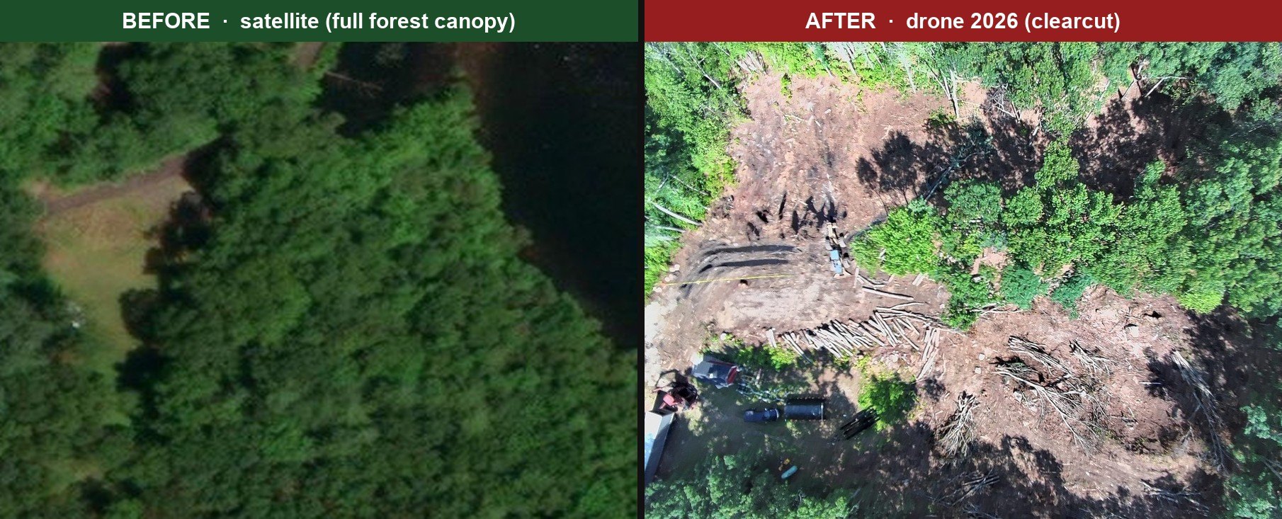
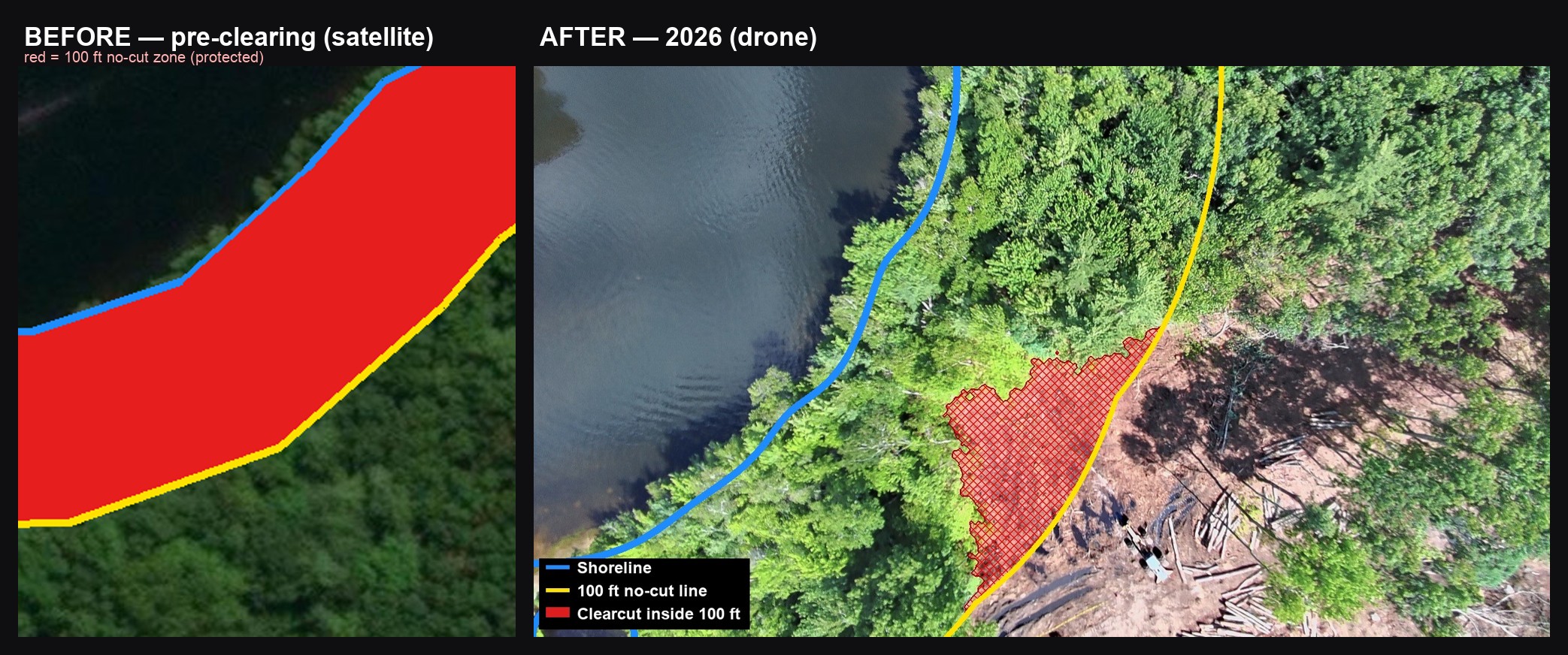
The satellite imagery still shows these lots as full forest canopy — it predates the cutting. The drone shows the same ground today: clearcut.
Big Island Pond — an independent record of construction on the lake
A great deal of construction is taking place on our lake. This site lets residents follow that progress and monitor compliance with the governing rules and regulations.
It serves a different purpose than the lake's official Facebook page: we focus on visual evidence that keeps residents informed. We do not take images down because the conditions they show may be considered controversial. The goal is simply to empower residents with useful information.
Everything posted here is documented in good faith from observable, dated imagery. This site is run by residents and is not affiliated with the lake association or its official page.
Protecting New Hampshire's lakes takes a level of accountability and transparency that simply doesn't exist today. This case is a textbook example of how it breaks down: contractors subcontract the work to one another, and when something goes wrong, every party claims to know nothing. Rules, regulations, and deed restrictions meant to protect the shoreline get flagrantly violated. And when concerned neighbors raise questions, the organizations that should be holding people accountable — lake associations and the like — receive donations, and the issues everyone once agreed mattered quietly fade away.
The satellite imagery still shows these lots as full forest canopy — it predates the cutting. The drone shows the same ground today: clearcut.
Each orange marker is a construction site. Click it to zoom in and see what's happening. Use the Map / Satellite toggle (top-right) to switch to aerial view.
The wetland was cleared and driven through with heavy equipment. It sits along the 17/19 property line, impacting both properties. Click the 📷 badges for ground photos. Lot lines are from Derry GIS and are being verified against the recorded deed.
Wetland (approx.) Lot lines (Derry GIS) Shoreline
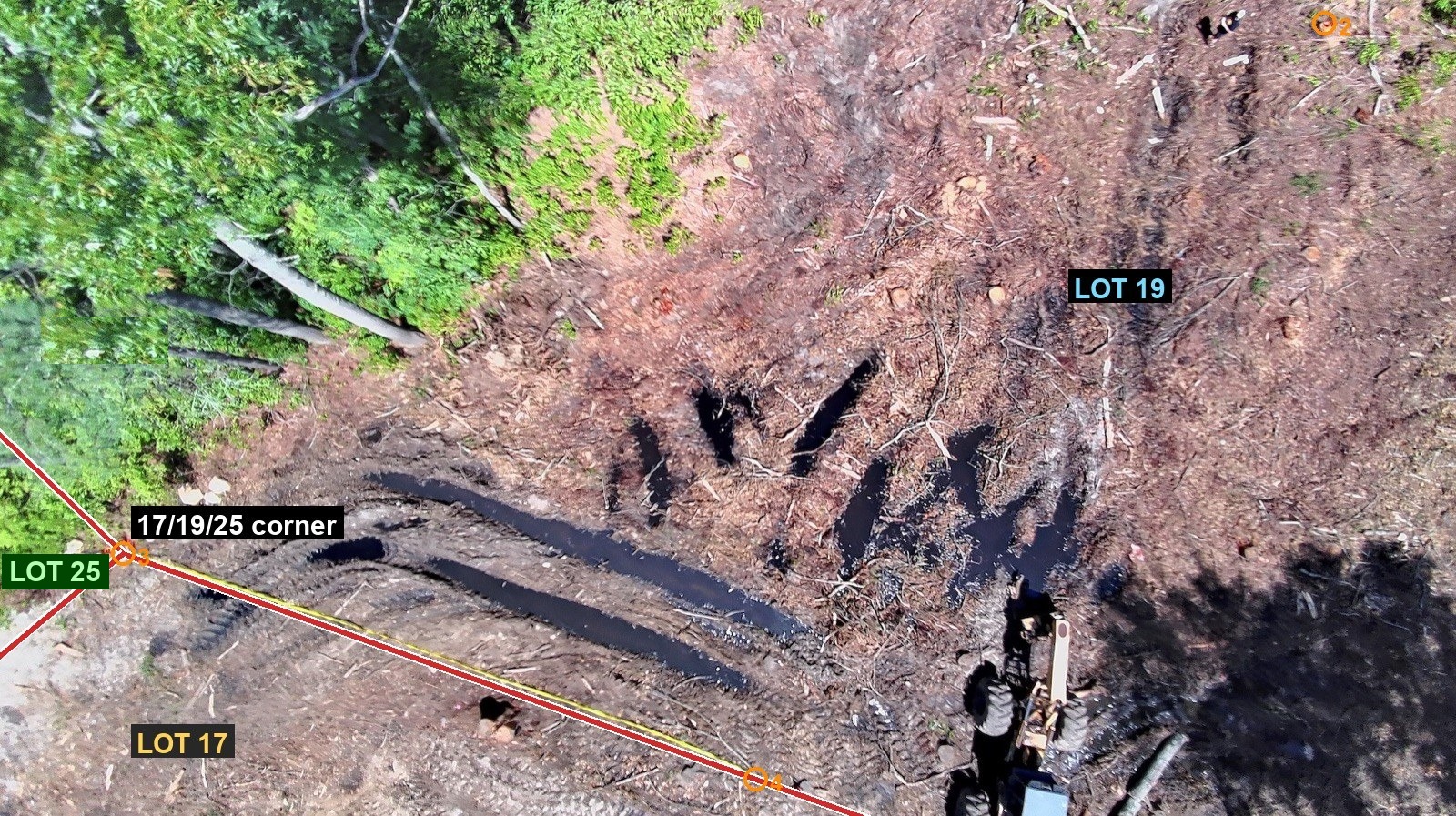
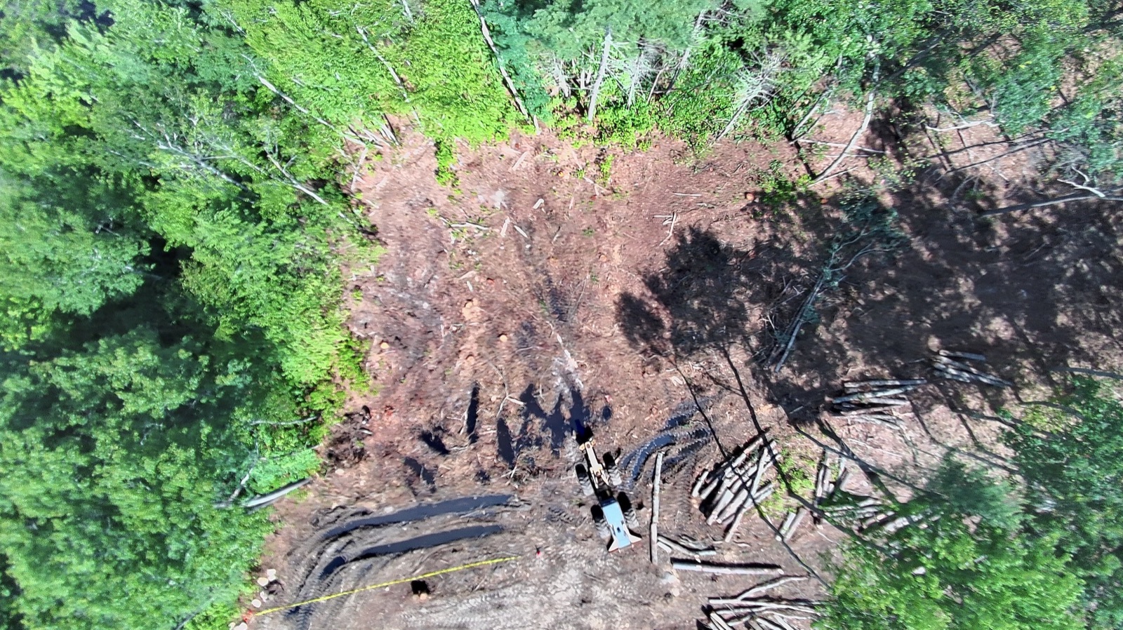
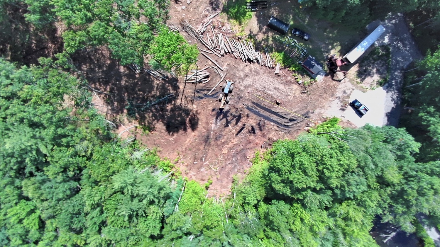
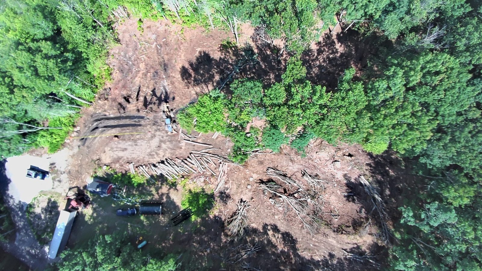
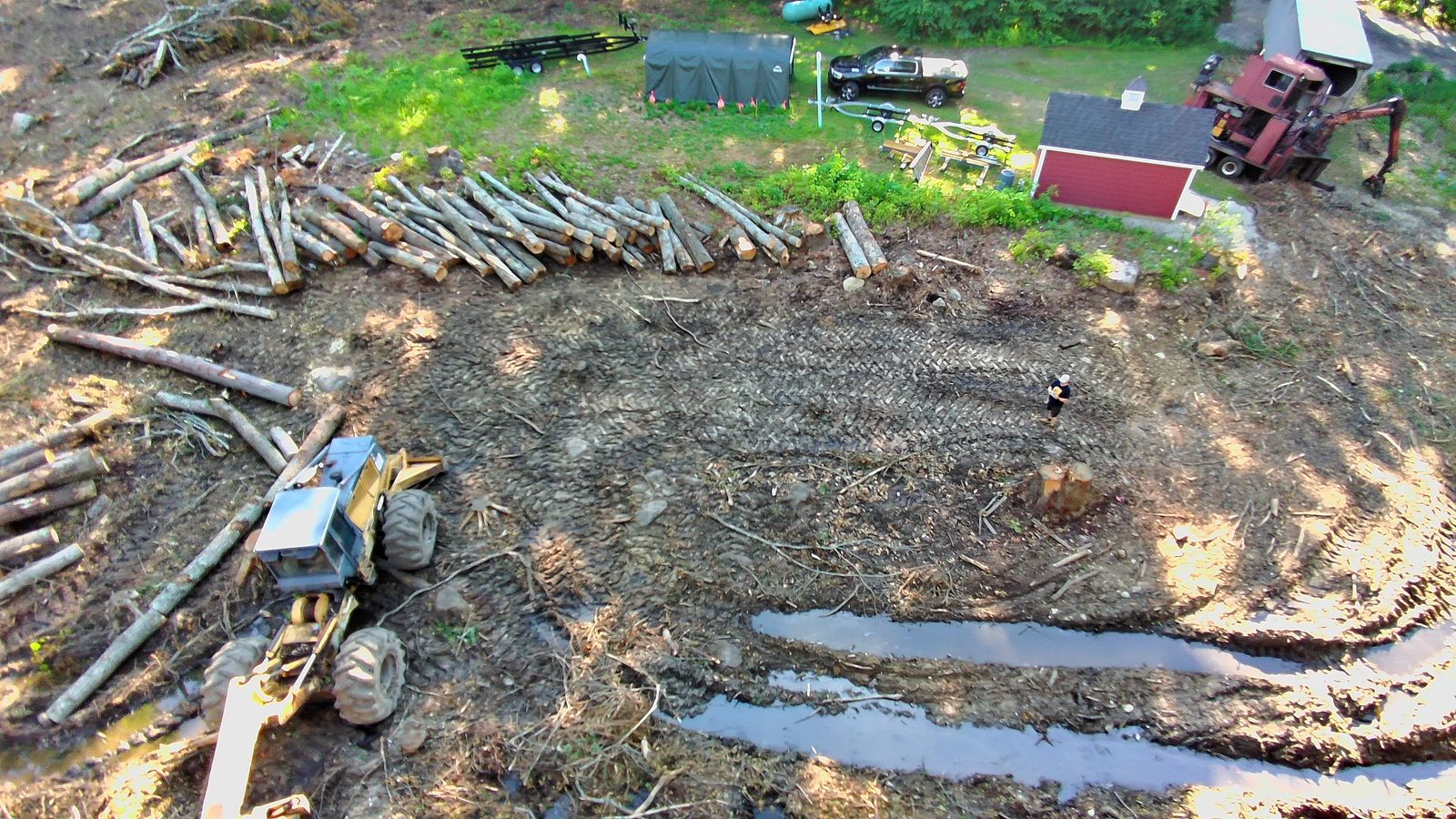
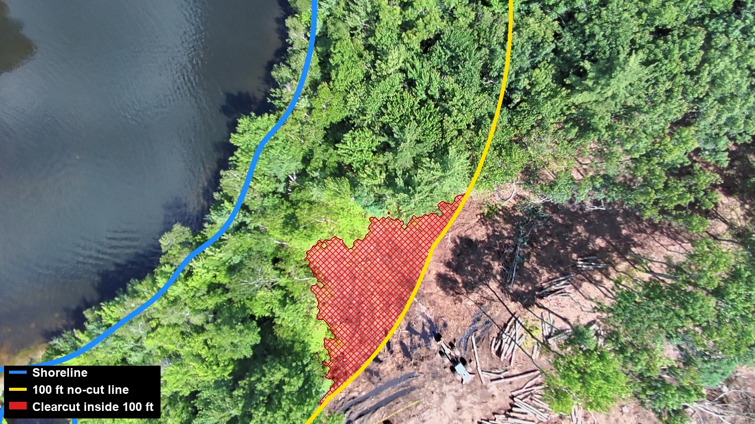
A deed restriction prohibits cutting trees within 100 feet of the shoreline. They cut to roughly 35 ft from the water — encroaching about 65 ft into the protected zone.
Postings will appear here soon. Check back as new photos and maps are added.
Contractors documented working on the construction in this area:
Residents can submit photos, maps, drone footage, or tips. Include a date and the location if you can.
Email a tipWant another property tracked here? Email us the property address along with any photos, and we'll add it to the map.
Add a property
Comments
Comments are welcome — keep them factual and civil, and stick to what you've observed. Posts are reviewed before they appear; spam and defamatory content won't be published.